Planimetric Elaborate - Italy
€6.90 + VAT
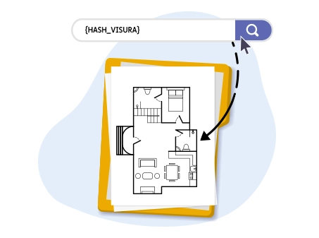
Access the official Planimetric Elaborate of any Italian property via API
The Building Layout Plan is the fundamental technical document used to identify the configuration of an entire building. The document is issued by the Revenue Agency and is a scaled reproduction of a building showing the perimeter of the structure, the subdivision of the apartments within it, common areas (courtyards, service rooms, stairwells and elevators, etc.), private and shared uncovered areas, etc.
Openapi allows you to request the official document directly via API integration, automating the retrieval of cadastral information for professional or management projects.
Unlike the cadastral floor plan (which concerns a single real estate unit), the Building Layout Plan provides an overall view of the building. It is a scaled reproduction that graphically represents the outline of the building and the subdivision of the units composing it.
What information it contains
By requesting the layout plan through our service, you will obtain a complete document that includes:
- Building perimeter: the external outline of the building on each floor;
- Subdivision of Sub-units: the exact position and boundaries of each individual real estate unit identified by a sub-unit number;
- Common Areas: indication of courtyards, stairwells, technical rooms, elevators, and condominium gardens (Common Areas Not Registered - BCNC);
- Covered and Uncovered Areas: shared terraces, roof terraces, and appurtenant areas;
- Topographic Data: names of bordering streets, orientation and/or waters bordering the building.
- Access points.
When it is necessary to request it
API integration for the building layout plan is essential for:
- Identification of common areas: Essential during purchase transactions or condominium management;
- Verification of Sub-units: To ensure the correct assignment of cadastral identification numbers;
- Building Procedures and Incentives: Required for certifications and designs involving the entire property.
Who can benefit from the Building Layout Plan via API
Automated access to official cadastral data is an essential tool for various professionals operating in the real estate, legal, and technical sectors.
Professional Roles and Use Cases
- Condominium Administrators: For drafting and updating the Condominium Registry, enabling the correct identification of all sub-units and common areas (BCNC) of the building;
- Real Estate Agents: To verify consistency between what is declared by the seller and the situation recorded in the Cadastre, avoiding surprises at closing;
- Notaries and Lawyers: During real estate due diligence phases and in the preparation of deeds of sale, inheritance proceedings, or divisions of inherited property;
- Architects, Surveyors, and Engineers: During renovation design or for the redevelopment of attics and common areas, where an overall view of the building is prioritized over the individual floor plan;
- Property Appraisers and Valuers: To accurately calculate appurtenant shares and properly assess market value based on common areas.
API Integration
Our APIs are designed to integrate seamlessly into any digital ecosystem, eliminating the waiting times associated with manual document downloads.
Integration Scenarios
- Management Software (ERP/CRM): Insert a "Cadastre" module into real estate management software to download the layout plan with one click directly within the building record;
- Automated Valuation Platforms (AVM): Enhance valuation algorithms with reliable data on the building’s composition;
- Building Maintenance Apps: Provide on-site technicians with the map of sub-units and common access points directly on tablets or smartphones;
- Citizen Service Portals: Integrate cadastral document requests within professional service portals or apps for managing personal assets.
Why choose Openapi for cadastral data
- Official Documents: Only data sourced directly from the national database of the Revenue Agency;
- Speed: Immediate response (within seconds) through optimized REST endpoints;
- Scalability: Ideal for real estate portals, technical firms, and management software requiring large volumes of requests.
REQUEST BUILDING LAYOUT PLAN
POST /elaborato_planimetrico
To proceed with requesting the Building Layout Plan via the Cadastre API, the following data must be provided in the request phase:
- Province
- Municipality
- Section (optional)
- Urban Section (optional)
- Sheet
- Parcel
During the request phase, it is also possible to set a callback to be notified when the request status changes and the document becomes available for download
WARNING: The "Urban Section" field is optional, but critical. If incorrect data or data not corresponding to the actual territorial situation of the relevant Municipality is entered, the error will be detected by the Revenue Agency’s system only after the API call has been made. In this case, the document cannot be issued, but the service cost will still be charged since the call was still made successfully. Therefore, it will be necessary to proceed with a new purchase using the correct data in order to obtain the document.
REQUEST EXAMPLE
To request the Building Layout Plan, we will submit the information with all the parameters necessary to correctly complete the request.
https://catasto.openapi.it/elaborato_planimetricoIn the payload, the previously indicated information will be provided, namely province, municipality, sheet, and parcel
{
   "provincia": "RM","
   "comune": "ROMA",
   "foglio": 872
   "particella": 405
  }
RESPONSE EXAMPLE
The response will include the previously indicated information, along with the request status and the ID required to subsequently check for status changes and later download the document once the process has been completed.
{
  "data": {
    "endpoint": "elaborato_planimetrico",
    "stato": "in_erogazione",
    "callback": false,
    "parametri": {
      "foglio": "872",
      "particella": "405"
      "comune": "H501#ROMA#4#0"
      "sezione": "null"
      "provincia": "ROMA Territorio-RM"
      "sezione_urbana": ""
    },
    "documento": null,
    "esito": null,
    "timestamp": 1655308768,
    "owner": "[email protected]",
    "id": "62aa01e18c75fd55685d07b3"
  },
  "success": true,
  "message": "",
  "error": null
}
CHECK REQUEST STATUS
GET /elaborato_planimetrico/{_id}
To check the status of the request, you can use the dedicated endpoint by providing the ID previously obtained in the response
REQUEST EXAMPLE
https://catasto.openapi.it/elaborato_planimetrico/62aa01e18c75fd55685d07b3RESPONSE EXAMPLE
In case of completed status, the response will include all information corresponding to the request.
{
  "data": {
    "endpoint": "elaborato_planimetrico",
    "stato": "evasa",
    "callback": false,
    "parametri": {
      "foglio": "872",
      "particella": "405"
      "comune": "H501#ROMA#4#0"
      "sezione": "null"
      "provincia": "ROMA Territorio-RM"
    },
    "documento": "62aa01e18c75fd55685d07b3.pdf",
    "esito": ok,
    "timestamp": 1655308768,
    "owner": "[email protected]",
    "id": "62aa01e18c75fd55685d07b3"
  },
  "success": true,
  "message": "",
  "error": null
}
DOWNLOAD THE DOCUMENT
GET /elaborato_planimetrico/{id}/documento
Once the request status is "evasa", the document can be downloaded using the GET method /elaborato_planimetrico/{id}/documento
REQUEST EXAMPLE
This is an example of a request using the previously obtained ID:
https://catasto.openapi.it/elaborato_planimetrico/62aa01e18c75fd55685d07b3/documentoThe request will allow you to directly download the document in PDF format.
The Building Layout Plan is a document required in certain specific contexts such as:
- to certify the completion of a new construction consisting of two or more real estate units and common areas
- to certify ongoing works for the construction of new real estate units within a building
- to certify any amendments to the layout plan already filed with the Cadastre offices
Only building layout plans filed after 1990, the year the Agenzia del Territorio was established, are available, and they are not available for the provinces of Trento and Bolzano.
Do you need help?
Haven't found the answer you're looking for?
Fill in all the details, we will get back to you as soon as possible!
The Planimetric Document service (in Italian "elaborato planimetrico") provides access to the official document available in the digital archives of the Italian Revenue Agency, which is a scaled drawing (1:500 or 1:200) of a building. It shows the boundaries of the building, the individual units within it, the common areas, and portions of exclusive or common outdoor spaces, indicated according to their subdivision into subunits.
The Planimetric Document service is ideal for those who need to access the official document to identify each real estate unit within the building and verify the perimeter and purpose of the common areas.
Unlike the cadastral plan, the Planimetric Document can be requested by anyone, even if they are not the property owner or an authorized representative.
The service allows access to the Planimetric Document for the entire national territory, except for the Autonomous Provinces of Trento and Bolzano, which independently manage their own cadastral and real estate databases.
Yes, through Openapi’s APIs, you can access over 28 services dedicated to the real estate sector:
- Postal Codes (CAP)
- Search Municipalities
- Basic and Advanced Municipalities
- Provinces, Regions, and Metropolitan Cities
- Suppressed Municipalities
- Geocoding and Reverse Geocoding
- Real Estate Valuation Start and Advanced (SMQ)
- Property Transactions (RMV)
- Property List from Cadastral Identifiers and Address
- Person Search and National Search
- Cadastral Property Data
- Cadastral Report
- National Mortgage Inspection
- Mortgage Inspection for Property and by Subject
- Mortgage Inspection of a Single Note
- Cadastral Plan
- Cadastral Map Extract for Companies
- Lease Contract Registration, Cancellation, and Extension
These services are available through different APIs: Docuengine, Cadastre, Real Estate.
The document is made available in a few seconds.
The cost of the service is €6.90 with prepaid charge.
Carbon free energy for Our Cloud ![]() Low CO2
Low CO2


© 2024 Openapi SpA, a single-member company, under the direction and control of Open Holding Srl.
Viale Filippo Tommaso Marinetti 221 - 00143 Rome - Business Register: 1378273, Share Capital: €50,000.00, VAT Number: IT12485671007, Recipient Code: 'USAL8PV' - Certified Email: 
Openapi is certified in: Quality System **UNI EN ISO 9001:2015** - Data Quality **ISO 25012:2014** - Security Management **ISO/IEC 27001:2022** - Geneder Equality According UNI PdR 125:2022
All prices are net of any VAT, stamp duty, registration fees, or other taxes that may be due. All logos listed on the portal are copyrighted and owned by their respective owners.


