Cadastral Map - Italy
€6.90 + VAT
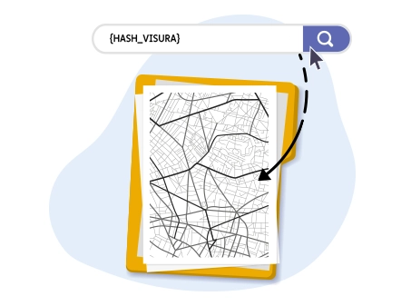
Access via API the official map extract of any municipal area on Italian territory
The Cadastral Map Extract is the official cartographic document issued by the Italian Revenue Agency (previously managed by the Land Registry or the Territory Agency).
It is a scaled graphical representation of a portion of municipal territory that allows precise visualization of the outlines of land parcels and buildings, identified through specific cadastral parcels (or map references).
Thanks to integration with Openapi APIs, professionals and companies can automate the request for this document, obtaining certified data in real time directly from ministerial databases.
What a Map Extract Contains
In addition to the geometric representation, the document includes conventional symbols essential for the technical interpretation of the area. Below are the main graphical elements:
- Parcel Number: Shown in bold at the center of the polygon; uniquely identifies the land parcel or building.
- "Brick" hatching: Graphically identifies the presence of urban buildings or elevated structures.
- Continuous lines: Delimit property boundaries and also indicate public roads and waterways.
- Directional arrows: Indicate the flow direction of waterways shown on the map.
- Control Points (Circle): Reference elements with known coordinates used by technicians (surveyors, architects) for topographic surveys.
- Trigonometric Points (Triangle with number): Points with precise geographic coordinates determined by the national geodetic network.
- "Y" symbol: Indicates the confirmation of a boundary characterized by a significant natural elevation difference, such as an escarpment or ravine.
The map extract allows verification of the boundaries of land parcels and buildings and, with additional cadastral searches, makes it possible to identify the registered owner of a specific land parcel or building.
What It Is Used For and Who Can Request It
The Map Extract is a public document. This means that, unlike the nominal cadastral report (subject to privacy restrictions), the map extract can be requested by anyone for any property or land parcel, without requiring authorization from the owner.
The main professional uses include:
- Boundary verification: Essential for property transactions, successions, or resolving neighborhood disputes.
- Building and Urban Planning Procedures: Required for submitting Building Permits (PdC) or Certified Notices of Commencement of Activity (SCIA).
- Real Estate Investigations: By cross-referencing map data with a Cadastral Report by Property, it is possible to accurately identify the cadastral entity (owners and ownership shares).
- Technical Design: Fundamental for cadastral subdivisions or for adding new buildings to the map (Cadastral Mapping Type).
Why Integrate the Map Extract via Openapi APIs
API integration makes it possible to scale the business by eliminating manual navigation of government portals. It is the ideal solution for:
- Management software for technical and legal firms.
- Real Estate portals looking to enrich property listings.
- Banks and insurance institutions for the assessment of real guarantees.
Who the Map Extract Is Useful For
The cadastral map extract is a cross-functional tool, essential for various professional figures who require objective and certified territorial data.
Thanks to the public nature of the data, access via Openapi APIs streamlines the workflow of:
1. Technical Area Professionals
For those operating in the construction and surveying sectors, the map extract is the starting point of every procedure:
- Surveyors and Architects: For drafting projects, urban planning variations, subdivisions, and cadastral mapping types in Pregeo.
- Civil Engineers: For analyzing the feasibility of structural works and checking territorial constraints.
- Agricultural Experts: For estimating agricultural land, verifying cultivated areas, and managing rural boundaries.
2. Real Estate and Credit Sector
Cartographic accuracy reduces risks related to transactions and valuations:
- Real Estate Agents: To provide potential buyers with a clear view of property boundaries and appurtenances, increasing transaction transparency.
- Property Valuers and Appraisers: To correctly identify the asset being valued and avoid parcel identification errors.
- Real Estate Companies: To analyze large property portfolios and identify development potential on buildable land.
3. Legal and Notarial Area
In the legal field, consistency between the actual state and cadastral maps is essential:
- Notaries: For the preparatory phase of deeds and to verify the continuity of registrations based on correct cadastral data.
- Lawyers: Especially in civil disputes concerning boundaries, statutory distances between buildings, and rights of way.
- Condominium Administrators: To correctly identify common areas, setbacks, and external appurtenances of the managed building.
4. Public Administration and Utility Providers
- Municipal Technical Offices: For updating zoning plans and managing the territory.
- Utilities (Electricity, Gas, Water): For planning the installation of infrastructure and technological networks, precisely locating the parcels affected by excavation works.
Private Citizens
Individual citizens can also benefit from this document to:
- Successions and Transfers: Identify inherited assets.
- DIY and Renovations: Obtain a general plan before consulting a technician for minor works or fencing.
MAP EXTRACT REQUEST
POST /estratto_mappa
To proceed with the Map Extract request via the Cadastral API, the following data must be provided during the request phase:
- Province
- Municipality
- Section (optional)
- Sheet
- Parcel
During the request phase, it is also possible to set a callback to be notified when the request changes status and becomes available for download.
REQUEST EXAMPLE
To request the Cadastral Map Extract, we will provide all the necessary parameters and data required to ensure the request is processed correctly.
https://catasto.openapi.it/estratto_mappaThe payload will include the previously indicated information, namely province, municipality, sheet, and parcel.
{
   "provincia": "RM","
   "comune": "ROMA",
   "foglio": 872
   "particella": 405
  }
RESPONSE EXAMPLE
The response will include the previously provided information, along with the request status and the ID required to later check status changes and download the document once the request has been processed.
{
  "data": {
    "entita": "immobile",
    "stato": "in_erogazione",
    "callback": false,
    "parametri": {
      "foglio": "872",
      "particella": "405"
      "comune": "H501#ROMA#4#0"
      "sezione": "null"
      "provincia": "ROMA Territorio-RM"
    },
    "documento": null,
    "esito": null,
    "timestamp": 1655308768,
    "owner": "[email protected]",
    "id": "628e41900e304d63044f857d"
  },
  "success": true,
  "message": "",
  "error": null
}
CHECK REQUEST STATUS
GET /estratto_mappa/{_id}
To check the status of the request, you can use the dedicated endpoint by passing the ID previously obtained in the response.
REQUEST EXAMPLE
https://catasto.openapi.it/estratto_mappa/628e41900e304d63044f857dRESPONSE EXAMPLE
If the status is processed, the response will include all the information corresponding to the request.
{
  "data": {
    "endpoint": "estratto_mappa",
    "stato": "evasa",
    "callback": false,
    "parametri": {
      "foglio": "872",
      "particella": "405"
      "comune": "H501#ROMA#4#0"
      "sezione": "null"
      "provincia": "ROMA Territorio-RM"
    },
    "documento": "628e41900e304d63044f857d.pdf",
    "esito": ok,
    "timestamp": 1653490064,
    "owner": "[email protected]",
    "id": "628e41900e304d63044f857d"
  },
  "success": true,
  "message": "",
  "error": null
}
DOWNLOAD THE DOCUMENT
GET /estratto_mappa/{id}/documento
Once the request status is "processed", it is possible to download the document via the GET method /estratto_mappa/{id}/documento.
REQUEST EXAMPLE
This is an example request using the previously obtained ID.
https://catasto.openapi.it/estratto_mappa/628e41900e304d63044f857d/documento
The request will allow you to directly download the document in PDF format.
Do you need help?
Haven't found the answer you're looking for?
Fill in all the details, we will get back to you as soon as possible!
The Cadastral Map Extract service (in italiano "estratto di mappa catastale") provides access to the official Cadastral Map Extract available in the digital archives of the Italian Revenue Agency, which is a graphical representation of a territory, typically at a 1:2000 scale. It includes data on a specific plot, as well as personal data and tax code of the property owners, and ownership shares.
The Cadastral Map Extract is ideal for those who need to understand the boundaries and relevant areas of a particular property or land and access the related cadastral data. Through additional services, users can also obtain information about the property owner or building.
Unlike the cadastral plan, the Cadastral Map Extract can be requested by anyone, even if they are not the property owner or authorized representative.
The service allows access to Cadastral Map Extracts for properties across the entire national territory, except for those located in the Autonomous Provinces of Trento and Bolzano, which manage their own cadastral and real estate databases independently.
Yes, through Openapi’s APIs, you can access over 28 services dedicated to the real estate sector:
- Postal Codes (CAP)
- Search Municipalities
- Basic and Advanced Municipalities
- Provinces, Regions, and Metropolitan Cities
- Suppressed Municipalities
- Geocoding and Reverse Geocoding
- Real Estate Valuation Start and Advanced (SMQ)
- Property Transactions (RMV)
- Property List from Cadastral Identifiers and Address
- Person Search and National Search
- Cadastral Property Data
- Cadastral Report
- National Mortgage Inspection
- Mortgage Inspection for Property and by Subject
- Mortgage Inspection of a Single Note
- Planimetric Document
- Cadastral Map Extract for Companies
- Lease Contract Registration, Cancellation, and Extension
- Registrierung, Stornierung und Verlängerung von Mietverträgen
These services are available through different APIs: Docuengine, Cadastre, Real Estate.
The document is made available in a few seconds.
The cost of the service is €6,90 with prepaid charge.
Carbon free energy for Our Cloud ![]() Low CO2
Low CO2


© 2024 Openapi SpA, a single-member company, under the direction and control of Open Holding Srl.
Viale Filippo Tommaso Marinetti 221 - 00143 Rome - Business Register: 1378273, Share Capital: €50,000.00, VAT Number: IT12485671007, Recipient Code: 'USAL8PV' - Certified Email: 
Openapi is certified in: Quality System **UNI EN ISO 9001:2015** - Data Quality **ISO 25012:2014** - Security Management **ISO/IEC 27001:2022** - Geneder Equality According UNI PdR 125:2022
All prices are net of any VAT, stamp duty, registration fees, or other taxes that may be due. All logos listed on the portal are copyrighted and owned by their respective owners.


